Geolocate

Soffratta topographic map

Click on the map to display elevation.

About this map

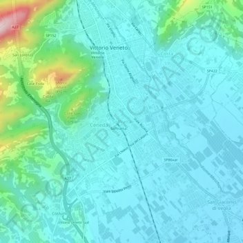
Name: Soffratta topographic map, elevation, terrain.

Location: Soffratta, Vittorio Veneto, Treviso, Veneto, 31029, Italia (45.95749 12.27952 45.99749 12.31952)

Average elevation: 564 ft

Minimum elevation: 331 ft

Maximum elevation: 1,804 ft

Gear up for your next adventure:

🔭Stargazing Telescopes - Perfect for camping in low-light pollution areas shown on maps
🚗GPS Dash Cams - Record your scenic drives through mountain passes and canyons
🧺Microfiber Travel Towels - Compact and fast-drying towels for trail use
🕶️GPS Smartphone Mount - Secure mount for phone navigation
🥘Titanium Cookware - Durable, featherlight pots and pans for backpacking

As an Amazon Associate, this site earns from qualifying purchases at no extra cost to you.