Geolocate

Berlin topographic map

Click on the map to display elevation.

About this map

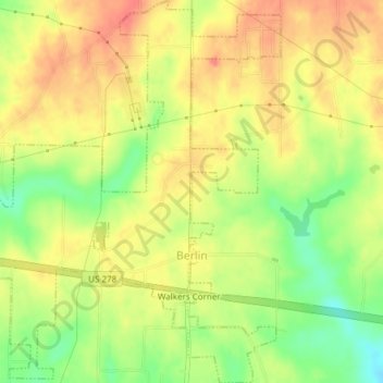
Name: Berlin topographic map, elevation, terrain.

Location: Berlin, Cullman County, Alabama, United States (34.17106 -86.76443 34.20235 -86.73343)

Average elevation: 820 ft

Minimum elevation: 709 ft

Maximum elevation: 896 ft

Cullman County trails, hiking, mountain biking, running and outdoor activities

Other topographic maps

Click on a map to view its topography, its elevation and its terrain.

Arkadelphia

United States > Alabama > Cullman County

Average elevation: 423 ft

Duck River

United States > Alabama > Cullman County

Average elevation: 771 ft

Crane Hill

United States > Alabama > Cullman County

Average elevation: 705 ft

Trimble

United States > Alabama > Cullman County

Average elevation: 607 ft

Hanceville

United States > Alabama > Cullman County > Hanceville

Average elevation: 584 ft

Gear up for your next adventure:

📡Handheld GPS Device - Reliable handheld GPS for outdoor navigation
🚑Emergency Bivvies - Heat-reflective sleeping bags for survival situations
🌎3D Topographic Globes - Raised relief globes for a tactile understanding of geography
🔥Camping Stove - Portable stove for camping and backcountry cooking
🔪Outdoor Multitools - Essential survival tools for gear repair and field use

As an Amazon Associate, this site earns from qualifying purchases at no extra cost to you.