
Thank you for supporting this site ❤️
Make a donation
Make a donation
Gear up for your next adventure:
As an Amazon Associate, this site earns from qualifying purchases at no extra cost to you.
Qudhaco topographic map
Click on the map to display elevation.
Thank you for supporting this site ❤️
Make a donation
Make a donation
Gear up for your next adventure:
As an Amazon Associate, this site earns from qualifying purchases at no extra cost to you.
About this map
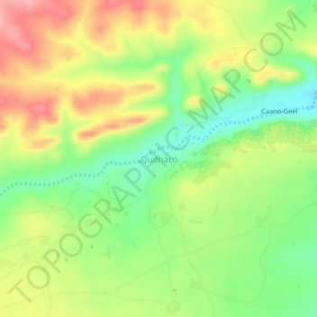
Name: Qudhaco topographic map, elevation, terrain.
Location: Qudhaco, Gabiley District, Woqooyi Galbeed, Somalia (9.70449 43.65232 9.74449 43.69232)
Average elevation: 4,728 ft
Minimum elevation: 4,528 ft
Maximum elevation: 4,957 ft
Thank you for supporting this site ❤️
Make a donation
Make a donation
Gear up for your next adventure:
As an Amazon Associate, this site earns from qualifying purchases at no extra cost to you.