
Río Chancay topographic map
Interactive map
Click on the map to display elevation.
About this map
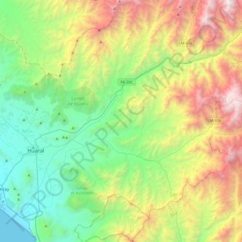
Name: Río Chancay topographic map, elevation, terrain.
Location: Río Chancay, Huaral, Provincia de Huaral, Lima, Perú (-11.61548 -77.24846 -11.27245 -76.81623)
Average elevation: 3,583 ft
Minimum elevation: 0 ft
Maximum elevation: 10,922 ft
Other topographic maps
Click on a map to view its topography, its elevation and its terrain.
Jesús del Valle
Perú > Lima > Huaral > Jesús del Valle
Jesús del Valle, Huaral, Provincia de Huaral, Lima, Perú
Average elevation: 607 ft