
Thank you for supporting this site ❤️
Make a donation
Make a donation
Gear up for your next adventure:
As an Amazon Associate, this site earns from qualifying purchases at no extra cost to you.
Pontoise topographic map
Click on the map to display elevation.
Thank you for supporting this site ❤️
Make a donation
Make a donation
Gear up for your next adventure:
As an Amazon Associate, this site earns from qualifying purchases at no extra cost to you.
About this map
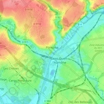
Name: Pontoise topographic map, elevation, terrain.
Location: Pontoise, Val-d'Oise, Ile-de-France, Metropolitan France, France (49.02418 2.07218 49.07311 2.12703)
Average elevation: 171 ft
Minimum elevation: 66 ft
Maximum elevation: 322 ft
Thank you for supporting this site ❤️
Make a donation
Make a donation
Gear up for your next adventure:
As an Amazon Associate, this site earns from qualifying purchases at no extra cost to you.