Geolocate

Wimml topographic map

Click on the map to display elevation.

About this map

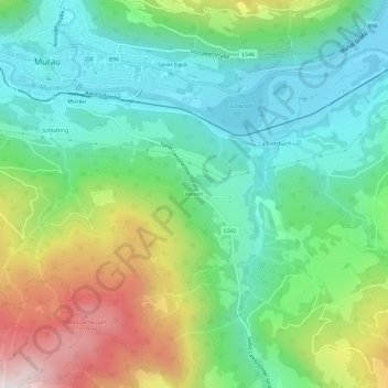
Name: Wimml topographic map, elevation, terrain.

Location: Wimml, Murau, Bezirk Murau, Styria, 8850, Austria (47.07867 14.17137 47.11867 14.21137)

Average elevation: 3,409 ft

Minimum elevation: 2,523 ft

Maximum elevation: 5,276 ft

Gear up for your next adventure:

📻Weather Alert Radios - Stay informed of storm risks while off-the-grid
🪶Camp Gear Gift Set - Perfect gift bundle for outdoor fans
🎒Hydration Pack - Hands‑free water reservoir for long hikes
🦶Hiking Gaiters - Keep debris and water out of your boots
🪶Wildlife Field Guides - Learn animal tracking and species ID

As an Amazon Associate, this site earns from qualifying purchases at no extra cost to you.