
Thank you for supporting this site ❤️
Make a donation
Make a donation
Gear up for your next adventure:
As an Amazon Associate, this site earns from qualifying purchases at no extra cost to you.
Leping topographic map
Click on the map to display elevation.
Thank you for supporting this site ❤️
Make a donation
Make a donation
Gear up for your next adventure:
As an Amazon Associate, this site earns from qualifying purchases at no extra cost to you.
About this map
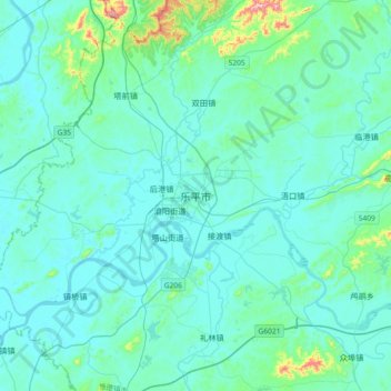
Name: Leping topographic map, elevation, terrain.
Location: Leping, Hougang, Leping, Jingdezhen, Jiangxi, China (28.82005 116.98830 29.14005 117.30830)
Average elevation: 171 ft
Minimum elevation: 36 ft
Maximum elevation: 1,332 ft
Thank you for supporting this site ❤️
Make a donation
Make a donation
Gear up for your next adventure:
As an Amazon Associate, this site earns from qualifying purchases at no extra cost to you.