
Wandre topographic map
Interactive map
Click on the map to display elevation.
About this map
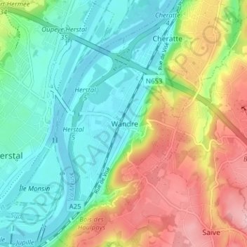
Name: Wandre topographic map, elevation, terrain.
Location: Wandre, Liège, Wallonie, 4000, Belgique (50.65021 5.63983 50.69021 5.67983)
Average elevation: 354 ft
Minimum elevation: 174 ft
Maximum elevation: 669 ft
Other topographic maps
Click on a map to view its topography, its elevation and its terrain.
Jupille-sur-Meuse
Belgique > Liège > Liège > Liège
Jupille-sur-Meuse, Liège, Wallonie, 4000, Belgique
Average elevation: 436 ft