
Thank you for supporting this site ❤️
Make a donation
Make a donation
Gear up for your next adventure:
As an Amazon Associate, this site earns from qualifying purchases at no extra cost to you.
Queràs topographic map
Click on the map to display elevation.
Thank you for supporting this site ❤️
Make a donation
Make a donation
Gear up for your next adventure:
As an Amazon Associate, this site earns from qualifying purchases at no extra cost to you.
About this map
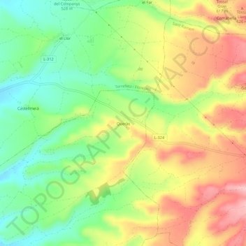
Name: Queràs topographic map, elevation, terrain.
Location: Queràs, Cervera, Ségarra, Catalogne, 25214, Espagne (41.71230 1.30301 41.75230 1.34301)
Average elevation: 1,834 ft
Minimum elevation: 1,578 ft
Maximum elevation: 2,129 ft
Thank you for supporting this site ❤️
Make a donation
Make a donation
Gear up for your next adventure:
As an Amazon Associate, this site earns from qualifying purchases at no extra cost to you.