
Make a donation
Gear up for your next adventure:
As an Amazon Associate, this site earns from qualifying purchases at no extra cost to you.
Kalwara topographic map
Click on the map to display elevation.
Make a donation
Gear up for your next adventure:
As an Amazon Associate, this site earns from qualifying purchases at no extra cost to you.
About this map
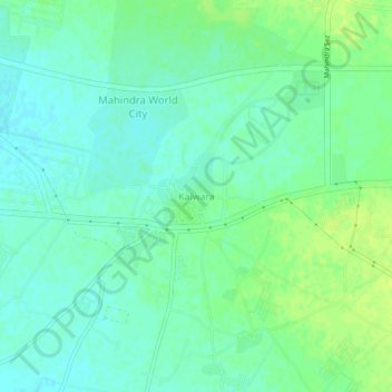
Name: Kalwara topographic map, elevation, terrain.
Location: Kalwara, Sanganer Tehsil, Jaipur, Rajasthan, 302037, India (26.77749 75.61623 26.81749 75.65623)
Average elevation: 1,181 ft
Minimum elevation: 1,158 ft
Maximum elevation: 1,207 ft
Make a donation
Gear up for your next adventure:
As an Amazon Associate, this site earns from qualifying purchases at no extra cost to you.
Other topographic maps
Click on a map to view its topography, its elevation and its terrain.
Haldighati Park
India > Rajasthan > Sanganer Tehsil > Jaipur Municipal Corporation
Average elevation: 1,220 ft
Ranvir shekhawat park
India > Rajasthan > Sanganer Tehsil > Jaipur Municipal Corporation
Average elevation: 1,355 ft
Haldighati Park
India > Rajasthan > Sanganer Tehsil > Jaipur Municipal Corporation
Average elevation: 1,220 ft