
Thank you for supporting this site ❤️
Make a donation
Make a donation
Gear up for your next adventure:
As an Amazon Associate, this site earns from qualifying purchases at no extra cost to you.
Pangari topographic map
Click on the map to display elevation.
Thank you for supporting this site ❤️
Make a donation
Make a donation
Gear up for your next adventure:
As an Amazon Associate, this site earns from qualifying purchases at no extra cost to you.
About this map
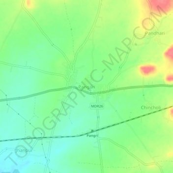
Name: Pangari topographic map, elevation, terrain.
Location: Pangari, Barshi, Solapur, Maharashtra, 413404, India (18.27420 75.84573 18.31420 75.88573)
Average elevation: 1,844 ft
Minimum elevation: 1,759 ft
Maximum elevation: 1,982 ft
Thank you for supporting this site ❤️
Make a donation
Make a donation
Gear up for your next adventure:
As an Amazon Associate, this site earns from qualifying purchases at no extra cost to you.