
Thank you for supporting this site ❤️
Make a donation
Make a donation
Gear up for your next adventure:
As an Amazon Associate, this site earns from qualifying purchases at no extra cost to you.
Tulungrejo topographic map
Click on the map to display elevation.
Thank you for supporting this site ❤️
Make a donation
Make a donation
Gear up for your next adventure:
As an Amazon Associate, this site earns from qualifying purchases at no extra cost to you.
About this map
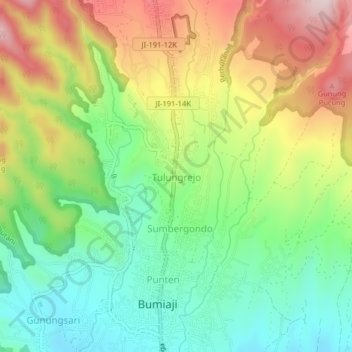
Name: Tulungrejo topographic map, elevation, terrain.
Location: Tulungrejo, Batu, Lowokwaru, Java, 65337, Indonesia (-7.84595 112.51005 -7.80595 112.55005)
Average elevation: 3,586 ft
Minimum elevation: 2,992 ft
Maximum elevation: 4,449 ft
Thank you for supporting this site ❤️
Make a donation
Make a donation
Gear up for your next adventure:
As an Amazon Associate, this site earns from qualifying purchases at no extra cost to you.