Geolocate

Ramdania topographic map

Click on the map to display elevation.

About this map
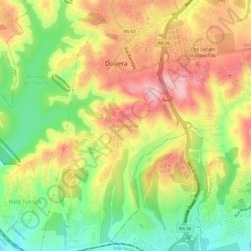
Name: Ramdania topographic map, elevation, terrain.

Location: Ramdania, Douera, Draria District, Algiers, 16000, Algeria (36.63902 2.92237 36.67902 2.96237)

Average elevation: 446 ft

Minimum elevation: 148 ft

Maximum elevation: 745 ft

Gear up for your next adventure:

🛰️Satellite Messengers - Emergency SOS and two-way messaging for off-grid adventures
🛰️Handheld GPS Units - Professional satellite navigators for precise backcountry mapping
🧭Compass with Lanyard - Easy‑carry compass for navigation
🦶Hiking Gaiters - Keep debris and water out of your boots
🔥Camping Stove - Portable stove for camping and backcountry cooking

As an Amazon Associate, this site earns from qualifying purchases at no extra cost to you.