
Thank you for supporting this site ❤️
Make a donation
Make a donation
Gear up for your next adventure:
As an Amazon Associate, this site earns from qualifying purchases at no extra cost to you.
Swargarohini topographic map
Click on the map to display elevation.
Thank you for supporting this site ❤️
Make a donation
Make a donation
Gear up for your next adventure:
As an Amazon Associate, this site earns from qualifying purchases at no extra cost to you.
About this map
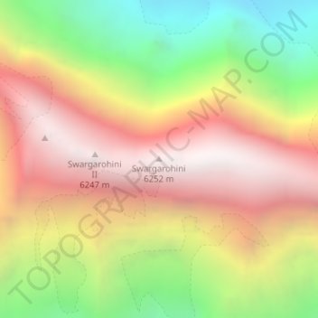
Name: Swargarohini topographic map, elevation, terrain.
Location: Swargarohini, Mori, Uttarkashi, Uttarakhand, India (31.10031 78.51218 31.10041 78.51228)
Average elevation: 17,421 ft
Minimum elevation: 14,065 ft
Maximum elevation: 20,341 ft
Thank you for supporting this site ❤️
Make a donation
Make a donation
Gear up for your next adventure:
As an Amazon Associate, this site earns from qualifying purchases at no extra cost to you.