
Thank you for supporting this site ❤️
Make a donation
Make a donation
Gear up for your next adventure:
As an Amazon Associate, this site earns from qualifying purchases at no extra cost to you.
Tanchí topographic map
Click on the map to display elevation.
Thank you for supporting this site ❤️
Make a donation
Make a donation
Gear up for your next adventure:
As an Amazon Associate, this site earns from qualifying purchases at no extra cost to you.
About this map
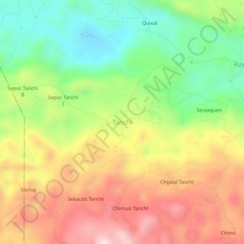
Name: Tanchí topographic map, elevation, terrain.
Location: Tanchí, San Pedro Carchá, Alta Verapaz, Guatemala (15.52257 -90.32373 15.56257 -90.28373)
Average elevation: 3,888 ft
Minimum elevation: 3,018 ft
Maximum elevation: 4,875 ft
Thank you for supporting this site ❤️
Make a donation
Make a donation
Gear up for your next adventure:
As an Amazon Associate, this site earns from qualifying purchases at no extra cost to you.