Geolocate

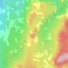
Bains Corner topographic map

Click on the map to display elevation.

About this map

Name: Bains Corner topographic map, elevation, terrain.

Location: Bains Corner, Saint Martins Parish, Village of Fundy-St. Martins, Saint John County, New Brunswick, Canada (45.30867 -65.66732 45.36943 -65.56025)

Average elevation: 289 ft

Minimum elevation: -3 ft

Maximum elevation: 889 ft

Other topographic maps

Click on a map to view its topography, its elevation and its terrain.
Gear up for your next adventure:

👖Convertible Hiking Pants - Versatile zip-off pants for changing altitudes and temperatures
👟Men's Trail Runners - Lightweight footwear for fast-paced exploration and light hiking
🎁Geography Themed Gifts - Unique gift ideas for map lovers and geography enthusiasts
🦶Carbon Trekking Poles - Reduce knee impact on steep descents with ultra-light poles
🗺️NatGeo Topo Maps - High-quality waterproof printed topographic maps of US Parks

As an Amazon Associate, this site earns from qualifying purchases at no extra cost to you.