Geolocate

Badain topographic map

Click on the map to display elevation.

About this map

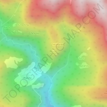
Name: Badain topographic map, elevation, terrain.

Location: Badain, Tikar, Rampur, Shimla, Himachal Pradesh, India (31.58512 77.72442 31.62512 77.76442)

Average elevation: 8,474 ft

Minimum elevation: 6,276 ft

Maximum elevation: 11,027 ft

Gear up for your next adventure:

🔥Camping Stove - Portable stove for camping and backcountry cooking
🪶Wildlife Field Guides - Learn animal tracking and species ID
Solar GPS Watches - Advanced multisport watches with built-in topographic maps
🛠️Outdoor Gear Repair Kit - Essential tools to fix gear on the trail
⛑️Personal Locator Beacon - Safety beacon for emergencies

As an Amazon Associate, this site earns from qualifying purchases at no extra cost to you.