
Tatopani topographic map
Interactive map
Click on the map to display elevation.
About this map
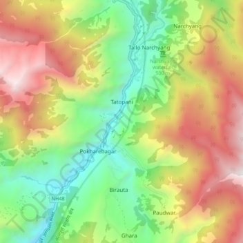
Name: Tatopani topographic map, elevation, terrain.
Location: Tatopani, Annapurna, Myagdi, Gandaki Pradesh, Nepal (28.47118 83.57239 28.51198 83.65537)
Average elevation: 6,663 ft
Minimum elevation: 3,596 ft
Maximum elevation: 10,653 ft
Other topographic maps
Click on a map to view its topography, its elevation and its terrain.