Geolocate

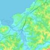
Bakarenea topographic map

Click on the map to display elevation.

About this map

Name: Bakarenea topographic map, elevation, terrain.

Location: Bakarenea, Saint-Jean-de-Luz, Bayonne, Pyrénées-Atlantiques, Nouvelle-Aquitaine, France métropolitaine, 64500, France (43.38880 -1.63447 43.42880 -1.59447)

Average elevation: 108 ft

Minimum elevation: -3 ft

Maximum elevation: 299 ft

Other topographic maps

Click on a map to view its topography, its elevation and its terrain.
Gear up for your next adventure:

🗺️Topographic Maps - Detailed topo maps for hiking, exploring and outdoor navigation
🧣Hiking Neck Gaiter - Multi‑use neck protection for outdoor weather
📷Action Cameras - Rugged cameras to document your journeys across rugged terrain
🪓Survival Multi‑Tool - Versatile tool for camp and trail tasks
🥘Titanium Cookware - Durable, featherlight pots and pans for backpacking

As an Amazon Associate, this site earns from qualifying purchases at no extra cost to you.