Geolocate

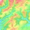
Weidingen topographic map

Click on the map to display elevation.

About this map

Name: Weidingen topographic map, elevation, terrain.

Location: Weidingen, Südeifel, Eifelkreis Bitburg-Prüm, Rijnland-Palts, Duitsland (49.99796 6.35079 50.02987 6.40122)

Average elevation: 1,417 ft

Minimum elevation: 1,070 ft

Maximum elevation: 1,772 ft

Other topographic maps

Click on a map to view its topography, its elevation and its terrain.

Buscht

Duitsland > Rijnland-Palts > Eifelkreis Bitburg-Prüm

Average elevation: 1,234 ft

Gear up for your next adventure:

📌Outdoor GPS Map App - Apps and devices for digital topographic navigation
🎒Gear Packing Cubes - Organize your backpack efficiently
🔭Telescopic Hiking Pole - Adjustable pole for hiking stability
🧥Men's Rain Shells - Premium waterproof and breathable jackets for mountain weather
🥤Water Filter Bottle - All‑in‑one filter bottle for safe hydration

As an Amazon Associate, this site earns from qualifying purchases at no extra cost to you.