
Pictured Rocks topographic map
Click on the map to display elevation.
About this map
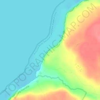
Name: Pictured Rocks topographic map, elevation, terrain.
Average elevation: 659 ft
Minimum elevation: 577 ft
Maximum elevation: 817 ft
Alger County trails, hiking, mountain biking, running and outdoor activities
Other topographic maps
Click on a map to view its topography, its elevation and its terrain.
Pictured Rocks National Lakeshore (Inner Buffer Zone)
United States > Michigan > Alger County > Munising Township
Average elevation: 722 ft