
Thank you for supporting this site ❤️
Make a donation
Make a donation
Gear up for your next adventure:
As an Amazon Associate, this site earns from qualifying purchases at no extra cost to you.
I Fiumi topographic map
Click on the map to display elevation.
Thank you for supporting this site ❤️
Make a donation
Make a donation
Gear up for your next adventure:
As an Amazon Associate, this site earns from qualifying purchases at no extra cost to you.
About this map
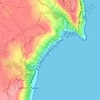
Name: I Fiumi topographic map, elevation, terrain.
Location: I Fiumi, Castro Marina, Castro, Lecce, Puglia, 73032, Italia (39.98644 18.40899 40.00644 18.42899)
Average elevation: 138 ft
Minimum elevation: 0 ft
Maximum elevation: 351 ft
Thank you for supporting this site ❤️
Make a donation
Make a donation
Gear up for your next adventure:
As an Amazon Associate, this site earns from qualifying purchases at no extra cost to you.