Geolocate

Broxbourne topographic map

Click on the map to display elevation.

About this map

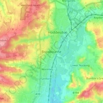
Name: Broxbourne topographic map, elevation, terrain.

Location: Broxbourne, Hertfordshire, England, EN10 7AA, United Kingdom (51.70657 -0.05908 51.78657 0.02092)

Average elevation: 177 ft

Minimum elevation: 52 ft

Maximum elevation: 364 ft

Gear up for your next adventure:

📱Heavy-Duty Phone Cases - Drop-proof and waterproof protection for outdoor navigation
🔦Compact Flashlight - Reliable flashlight for emergencies
🔋Rechargeable Batteries - Power up your outdoor devices
⛑️Personal Locator Beacon - Safety beacon for emergencies
📻Weather Alert Radios - Stay informed of storm risks while off-the-grid

As an Amazon Associate, this site earns from qualifying purchases at no extra cost to you.