
Thank you for supporting this site ❤️
Make a donation
Make a donation
Gear up for your next adventure:
As an Amazon Associate, this site earns from qualifying purchases at no extra cost to you.
Esqueda topographic map
Click on the map to display elevation.
Thank you for supporting this site ❤️
Make a donation
Make a donation
Gear up for your next adventure:
As an Amazon Associate, this site earns from qualifying purchases at no extra cost to you.
About this map
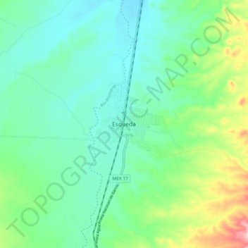
Name: Esqueda topographic map, elevation, terrain.
Location: Esqueda, Fronteras, Sonora, México (30.68321 -109.62807 30.76321 -109.54807)
Average elevation: 4,052 ft
Minimum elevation: 3,868 ft
Maximum elevation: 4,590 ft
Thank you for supporting this site ❤️
Make a donation
Make a donation
Gear up for your next adventure:
As an Amazon Associate, this site earns from qualifying purchases at no extra cost to you.