
Make a donation
Gear up for your next adventure:
As an Amazon Associate, this site earns from qualifying purchases at no extra cost to you.
Kollertshof topographic map
Click on the map to display elevation.
Make a donation
Gear up for your next adventure:
As an Amazon Associate, this site earns from qualifying purchases at no extra cost to you.
About this map
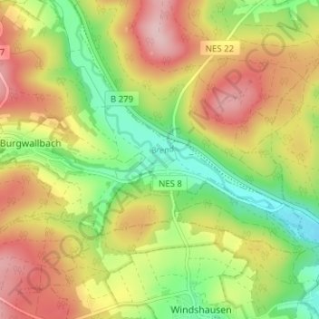
Name: Kollertshof topographic map, elevation, terrain.
Average elevation: 1,158 ft
Minimum elevation: 853 ft
Maximum elevation: 1,486 ft
Make a donation
Gear up for your next adventure:
As an Amazon Associate, this site earns from qualifying purchases at no extra cost to you.
Other topographic maps
Click on a map to view its topography, its elevation and its terrain.
Schönau a.d.Brend
Deutschland > Bayern > Landkreis Rhön-Grabfeld > Schönau a.d.Brend
Nördlich von Schönau befindet sich seit 1965 auf dem 425 Meter hohen Markberg das schon von der B 279 aus sichtbare Markbergkreuz. Das erste, 19 Meter hohe Markbergkreuz bestand aus Fichtenholz und wurde 1973 wegen seines schlechten Zustandes durch ein Kreuz gleicher Höhe aus Lärchenholz ersetzt. 1998…
Average elevation: 1,368 ft