
Thank you for supporting this site ❤️
Make a donation
Make a donation
Gear up for your next adventure:
As an Amazon Associate, this site earns from qualifying purchases at no extra cost to you.
Queixadoiro topographic map
Click on the map to display elevation.
Thank you for supporting this site ❤️
Make a donation
Make a donation
Gear up for your next adventure:
As an Amazon Associate, this site earns from qualifying purchases at no extra cost to you.
About this map
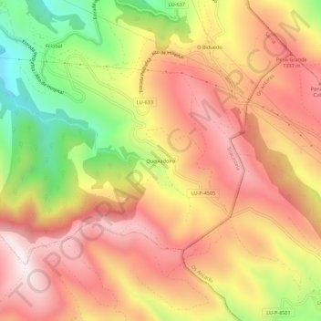
Name: Queixadoiro topographic map, elevation, terrain.
Location: Queixadoiro, Triacastela, Sarria, Lugo, Galicia, 27632, España (42.70972 -7.20654 42.74972 -7.16654)
Average elevation: 3,832 ft
Minimum elevation: 2,470 ft
Maximum elevation: 4,793 ft
Thank you for supporting this site ❤️
Make a donation
Make a donation
Gear up for your next adventure:
As an Amazon Associate, this site earns from qualifying purchases at no extra cost to you.
Other topographic maps
Click on a map to view its topography, its elevation and its terrain.