
Thank you for supporting this site ❤️
Make a donation
Make a donation
Gear up for your next adventure:
As an Amazon Associate, this site earns from qualifying purchases at no extra cost to you.
Yaurilla topographic map
Click on the map to display elevation.
Thank you for supporting this site ❤️
Make a donation
Make a donation
Gear up for your next adventure:
As an Amazon Associate, this site earns from qualifying purchases at no extra cost to you.
About this map
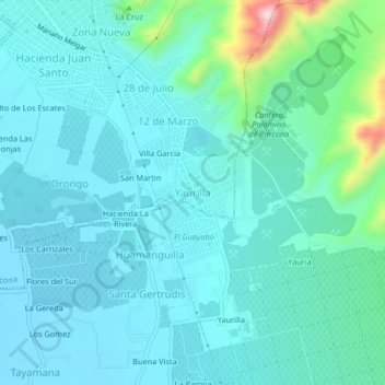
Name: Yaurilla topographic map, elevation, terrain.
Location: Yaurilla, Parcona, Ica, 11000, Perú (-14.08739 -75.70372 -14.04739 -75.66372)
Average elevation: 1,496 ft
Minimum elevation: 1,339 ft
Maximum elevation: 2,369 ft
Thank you for supporting this site ❤️
Make a donation
Make a donation
Gear up for your next adventure:
As an Amazon Associate, this site earns from qualifying purchases at no extra cost to you.