Geolocate

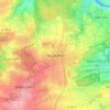
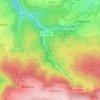
Remchingen topographic map

Click on the map to display elevation.

About this map

Name: Remchingen topographic map, elevation, terrain.

Location: Remchingen, Enzkreis, Baden-Württemberg, 75196, Germany (48.91323 8.53428 48.98989 8.61349)

Average elevation: 735 ft

Minimum elevation: 456 ft

Maximum elevation: 1,142 ft

Other topographic maps

Click on a map to view its topography, its elevation and its terrain.

Niefern

Germany > Baden-Württemberg > Enzkreis

Average elevation: 1,017 ft

Bauschlott

Germany > Baden-Württemberg > Enzkreis

Average elevation: 1,014 ft

Göbrichen

Germany > Baden-Württemberg > Enzkreis

Average elevation: 1,070 ft

Schlossbergturm

Germany > Baden-Württemberg > Enzkreis > Sternenfels

Average elevation: 1,050 ft

Enzberg

Germany > Baden-Württemberg > Enzkreis > Mühlacker

Average elevation: 945 ft

Holzbachtal

Germany > Baden-Württemberg > Enzkreis > Straubenhardt > Langenalb

Average elevation: 1,473 ft

Gear up for your next adventure:

🔌Solar Panel Charger - Charge gear sustainably outdoors
🌎3D Topographic Globes - Raised relief globes for a tactile understanding of geography
🔦Powerful Headlamps - Ultra-bright hands-free lighting for night navigation
🪶Multi‑Purpose Knife - Useful blade for camp and trail
🗺️Topographic Maps - Detailed topo maps for hiking, exploring and outdoor navigation

As an Amazon Associate, this site earns from qualifying purchases at no extra cost to you.