
Thank you for supporting this site ❤️
Make a donation
Make a donation
Gear up for your next adventure:
As an Amazon Associate, this site earns from qualifying purchases at no extra cost to you.
Masi topographic map
Click on the map to display elevation.
Thank you for supporting this site ❤️
Make a donation
Make a donation
Gear up for your next adventure:
As an Amazon Associate, this site earns from qualifying purchases at no extra cost to you.
About this map
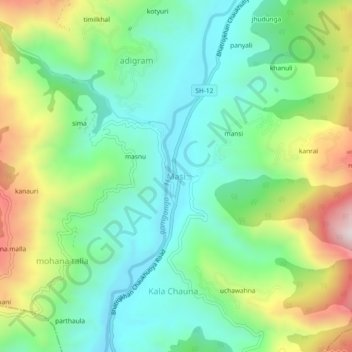
Name: Masi topographic map, elevation, terrain.
Location: Masi, Chaukhutiya, Almora District, Uttarakhand, 263658, India (29.79827 79.26147 29.83827 79.30147)
Average elevation: 3,478 ft
Minimum elevation: 2,762 ft
Maximum elevation: 4,925 ft
Thank you for supporting this site ❤️
Make a donation
Make a donation
Gear up for your next adventure:
As an Amazon Associate, this site earns from qualifying purchases at no extra cost to you.