
Thank you for supporting this site ❤️
Make a donation
Make a donation
Gear up for your next adventure:
As an Amazon Associate, this site earns from qualifying purchases at no extra cost to you.
Kanda topographic map
Click on the map to display elevation.
Thank you for supporting this site ❤️
Make a donation
Make a donation
Gear up for your next adventure:
As an Amazon Associate, this site earns from qualifying purchases at no extra cost to you.
About this map
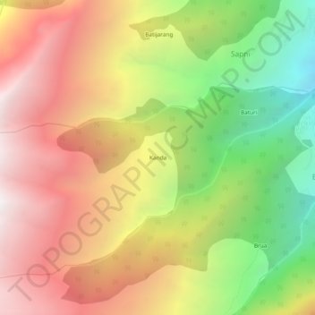
Name: Kanda topographic map, elevation, terrain.
Location: Kanda, Sangla, Kinnaur District, Himachal Pradesh, India (31.45067 78.13392 31.49067 78.17392)
Average elevation: 10,262 ft
Minimum elevation: 6,401 ft
Maximum elevation: 13,724 ft
Thank you for supporting this site ❤️
Make a donation
Make a donation
Gear up for your next adventure:
As an Amazon Associate, this site earns from qualifying purchases at no extra cost to you.