
Thank you for supporting this site ❤️
Make a donation
Make a donation
Gear up for your next adventure:
As an Amazon Associate, this site earns from qualifying purchases at no extra cost to you.
Metti topographic map
Click on the map to display elevation.
Thank you for supporting this site ❤️
Make a donation
Make a donation
Gear up for your next adventure:
As an Amazon Associate, this site earns from qualifying purchases at no extra cost to you.
About this map
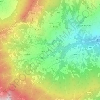
Name: Metti topographic map, elevation, terrain.
Location: Metti, Bore, Parma, Emilia-Romagna, Italia (44.68392 9.78154 44.72392 9.82154)
Average elevation: 2,244 ft
Minimum elevation: 1,250 ft
Maximum elevation: 3,629 ft
Thank you for supporting this site ❤️
Make a donation
Make a donation
Gear up for your next adventure:
As an Amazon Associate, this site earns from qualifying purchases at no extra cost to you.