
Make a donation
Gear up for your next adventure:
As an Amazon Associate, this site earns from qualifying purchases at no extra cost to you.
Barmstedt topographic map
Click on the map to display elevation.
Make a donation
Gear up for your next adventure:
As an Amazon Associate, this site earns from qualifying purchases at no extra cost to you.
Barmstedt
Der Name wurde erstmals 1140 als Barmiste verschriftlicht. 1212 ist Barmetstede geschrieben worden und ein Schriftzeugnis von 1221 lautet Barmestide. Es liegen niederdeutsch barm und -stedt zugrunde. Die Bedeutung ist ‚Siedlung an der Anhöhe‘.
Make a donation
Gear up for your next adventure:
As an Amazon Associate, this site earns from qualifying purchases at no extra cost to you.
About this map
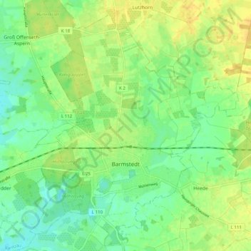
Name: Barmstedt topographic map, elevation, terrain.
Average elevation: 49 ft
Minimum elevation: 10 ft
Maximum elevation: 89 ft
Make a donation
Gear up for your next adventure:
As an Amazon Associate, this site earns from qualifying purchases at no extra cost to you.
Other topographic maps
Click on a map to view its topography, its elevation and its terrain.
Tävsmoor/Haselauer Moor
Deutschland > Schleswig-Holstein > Kreis Pinneberg > Appen
Average elevation: 30 ft
Stadtpark Lieth
Deutschland > Schleswig-Holstein > Kreis Pinneberg > Elmshorn
Average elevation: 26 ft
Make a donation
Gear up for your next adventure:
As an Amazon Associate, this site earns from qualifying purchases at no extra cost to you.
Liether Kalkgrube
Deutschland > Schleswig-Holstein > Kreis Pinneberg > Klein Nordende
Average elevation: 46 ft