
Thank you for supporting this site ❤️
Make a donation
Make a donation
Gear up for your next adventure:
As an Amazon Associate, this site earns from qualifying purchases at no extra cost to you.
Chaullabamba topographic map
Click on the map to display elevation.
Thank you for supporting this site ❤️
Make a donation
Make a donation
Gear up for your next adventure:
As an Amazon Associate, this site earns from qualifying purchases at no extra cost to you.
About this map
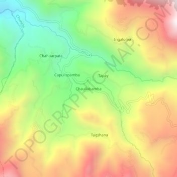
Name: Chaullabamba topographic map, elevation, terrain.
Location: Chaullabamba, Chunchi, Chimborazo, Ecuador (-2.35155 -78.90360 -2.31155 -78.86360)
Average elevation: 9,390 ft
Minimum elevation: 7,408 ft
Maximum elevation: 11,542 ft
Thank you for supporting this site ❤️
Make a donation
Make a donation
Gear up for your next adventure:
As an Amazon Associate, this site earns from qualifying purchases at no extra cost to you.