
Thank you for supporting this site ❤️
Make a donation
Make a donation
Gear up for your next adventure:
As an Amazon Associate, this site earns from qualifying purchases at no extra cost to you.
Carihuairazo topographic map
Click on the map to display elevation.
Thank you for supporting this site ❤️
Make a donation
Make a donation
Gear up for your next adventure:
As an Amazon Associate, this site earns from qualifying purchases at no extra cost to you.
About this map
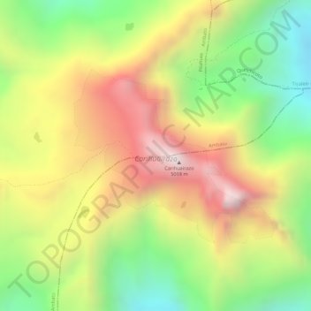
Name: Carihuairazo topographic map, elevation, terrain.
Location: Carihuairazo, Mocha, Pilahuin, Mocha, Tungurahua, Ecuador (-1.41479 -78.75998 -1.39969 -78.74266)
Average elevation: 15,000 ft
Minimum elevation: 13,648 ft
Maximum elevation: 16,296 ft
Thank you for supporting this site ❤️
Make a donation
Make a donation
Gear up for your next adventure:
As an Amazon Associate, this site earns from qualifying purchases at no extra cost to you.