
Cabeça do Velho topographic map
Interactive map
Click on the map to display elevation.
About this map
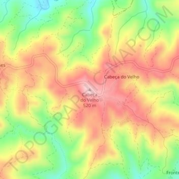
Name: Cabeça do Velho topographic map, elevation, terrain.
Location: Cabeça do Velho, São Brás de Alportel, Faro, Algarve, Portugal (37.24465 -7.83615 37.24475 -7.83605)
Average elevation: 1,355 ft
Minimum elevation: 938 ft
Maximum elevation: 1,719 ft
Other topographic maps
Click on a map to view its topography, its elevation and its terrain.
Arroteia
Portugal > Algarve > São Brás de Alportel
Arroteia, São Brás de Alportel, Faro, Algarve, 8150-101, Portugal
Average elevation: 932 ft