
Arroteia topographic map
Interactive map
Click on the map to display elevation.
About this map
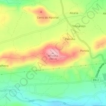
Name: Arroteia topographic map, elevation, terrain.
Average elevation: 932 ft
Minimum elevation: 673 ft
Maximum elevation: 1,260 ft
Other topographic maps
Click on a map to view its topography, its elevation and its terrain.
Cabeça do Velho
Portugal > Algarve > São Brás de Alportel
Cabeça do Velho, São Brás de Alportel, Faro, Algarve, Portugal
Average elevation: 1,355 ft