
Make a donation
Gear up for your next adventure:
As an Amazon Associate, this site earns from qualifying purchases at no extra cost to you.
White Plains topographic map
Click on the map to display elevation.
Make a donation
Gear up for your next adventure:
As an Amazon Associate, this site earns from qualifying purchases at no extra cost to you.
About this map
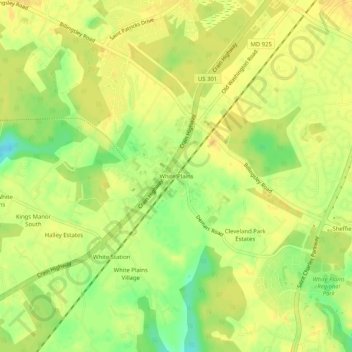
Name: White Plains topographic map, elevation, terrain.
Location: White Plains, Charles County, Maryland, 20603, United States (38.57040 -76.96025 38.61040 -76.92025)
Average elevation: 200 ft
Minimum elevation: 141 ft
Maximum elevation: 223 ft
Charles County trails, hiking, mountain biking, running and outdoor activities
Make a donation
Gear up for your next adventure:
As an Amazon Associate, this site earns from qualifying purchases at no extra cost to you.
Other topographic maps
Click on a map to view its topography, its elevation and its terrain.
Chapman State Park
United States > Maryland > Charles County > Indian Head > Chapman Landing
Average elevation: 62 ft
Make a donation
Gear up for your next adventure:
As an Amazon Associate, this site earns from qualifying purchases at no extra cost to you.