
Россия topographic map
Interactive map
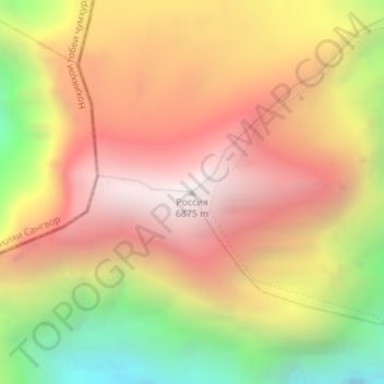
Click on the map to display elevation.
About this map
Name: Россия topographic map, elevation, terrain.
Average elevation: 20,013 ft
Minimum elevation: 16,690 ft
Maximum elevation: 22,513 ft
Other topographic maps
Click on a map to view its topography, its elevation and its terrain.
Lenin Peak
Tajikistan > Gorno-Badakhshan Autonomous Region > Murghob District
Lenin Peak, Murghob District, Gorno-Badakhshan Autonomous Region, Tajikistan
Average elevation: 21,535 ft
Pamir Mountains
Tajikistan > Gorno-Badakhshan Autonomous Region > Murghob District
Pamir Mountains, Murghob District, Gorno-Badakhshan Autonomous Region, Tajikistan
Average elevation: 20,850 ft