
Thank you for supporting this site ❤️
Make a donation
Make a donation
Gear up for your next adventure:
As an Amazon Associate, this site earns from qualifying purchases at no extra cost to you.
Lumajo topographic map
Click on the map to display elevation.
Thank you for supporting this site ❤️
Make a donation
Make a donation
Gear up for your next adventure:
As an Amazon Associate, this site earns from qualifying purchases at no extra cost to you.
About this map
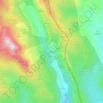
Name: Lumajo topographic map, elevation, terrain.
Location: Lumajo, Villablino, León, Castilla y León, España (42.96367 -6.27781 43.00367 -6.23781)
Average elevation: 5,016 ft
Minimum elevation: 4,049 ft
Maximum elevation: 6,591 ft
Thank you for supporting this site ❤️
Make a donation
Make a donation
Gear up for your next adventure:
As an Amazon Associate, this site earns from qualifying purchases at no extra cost to you.