
Merana topographic map
Click on the map to display elevation.
About this map
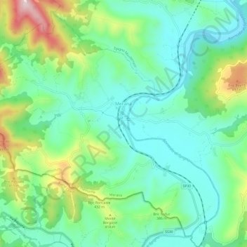
Name: Merana topographic map, elevation, terrain.
Location: Merana, Alessandria, Piedmont, Italy (44.49576 8.26104 44.53494 8.32122)
Average elevation: 1,073 ft
Minimum elevation: 732 ft
Maximum elevation: 1,893 ft
Other topographic maps
Click on a map to view its topography, its elevation and its terrain.