
Thank you for supporting this site ❤️
Make a donation
Make a donation
Gear up for your next adventure:
As an Amazon Associate, this site earns from qualifying purchases at no extra cost to you.
Cerdeira topographic map
Click on the map to display elevation.
Thank you for supporting this site ❤️
Make a donation
Make a donation
Gear up for your next adventure:
As an Amazon Associate, this site earns from qualifying purchases at no extra cost to you.
About this map
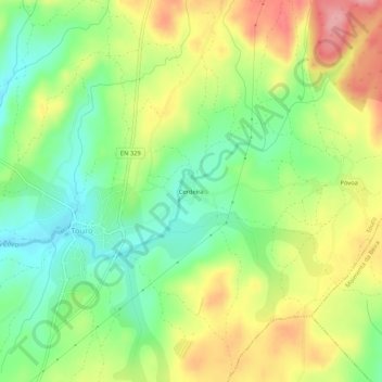
Name: Cerdeira topographic map, elevation, terrain.
Location: Cerdeira, Touro, Vila Nova de Paiva, Viseu, 3650-081, Portugal (40.87943 -7.75270 40.91943 -7.71270)
Average elevation: 2,740 ft
Minimum elevation: 2,562 ft
Maximum elevation: 2,966 ft
Thank you for supporting this site ❤️
Make a donation
Make a donation
Gear up for your next adventure:
As an Amazon Associate, this site earns from qualifying purchases at no extra cost to you.