Geolocate

Lesser Antilles topographic map

Click on the map to display elevation.

About this map

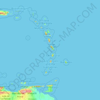
Name: Lesser Antilles topographic map, elevation, terrain.

Location: Lesser Antilles, Trinidad and Tobago (10.04282 -70.06384 18.74958 -59.42012)

Average elevation: 43 ft

Minimum elevation: 0 ft

Maximum elevation: 7,454 ft

Other topographic maps

Click on a map to view its topography, its elevation and its terrain.

Paramin

Trinidad and Tobago > Diego Martin

Average elevation: 942 ft

Charlotteville

Trinidad and Tobago

Average elevation: 335 ft

Little Tobago

Trinidad and Tobago

Average elevation: 23 ft

Port of Spain

Trinidad and Tobago > Port of Spain > Port of Spain

Some of the city lies on land reclaimed from the Gulf of Paria, the calm sheltered bay separating Trinidad from Venezuela, while other parts climb into the hills above the city. Geographically, the Port of Port of Spain is ideal for maritime traffic, providing a natural harbour on Trinidad's north-western…

Average elevation: 194 ft

Sea Lots

Trinidad and Tobago > Port of Spain > Sea Lots

Average elevation: 72 ft

Freeport

Trinidad and Tobago > Couva-Tabaquite-Talparo

The estimated terrain elevation above sea level is 27 metres.

Average elevation: 79 ft

Tunapuna

Trinidad and Tobago > Tunapuna-Piarco

Average elevation: 305 ft

Scarborough

Trinidad and Tobago

Average elevation: 112 ft

Crown Point

Trinidad and Tobago > Tobago

Average elevation: 7 ft

Gear up for your next adventure:

🪶Thermal Camp Blanket - Extra warmth for cold nights
🧭Pro Hiking Compasses - High-accuracy liquid-filled compasses for topographic orientation
📡GPS Antenna Upgrade - Enhance GPS reception in remote terrain
🪑Ultralight Camp Chairs - Portable seating for resting after a long day of mapping
🗃️Trail First Aid Kit - Essential kit for outdoor injuries and emergencies

As an Amazon Associate, this site earns from qualifying purchases at no extra cost to you.