
Thank you for supporting this site ❤️
Make a donation
Make a donation
Gear up for your next adventure:
As an Amazon Associate, this site earns from qualifying purchases at no extra cost to you.
I Coi topographic map
Click on the map to display elevation.
Thank you for supporting this site ❤️
Make a donation
Make a donation
Gear up for your next adventure:
As an Amazon Associate, this site earns from qualifying purchases at no extra cost to you.
About this map
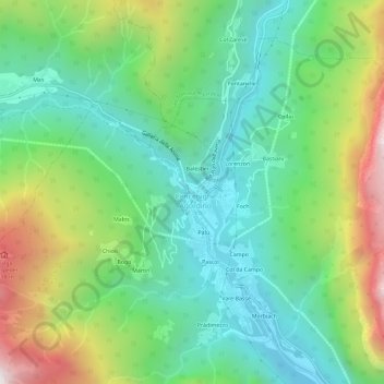
Name: I Coi topographic map, elevation, terrain.
Location: I Coi, Cencenighe Agordino, Belluno, Veneto, Italia (46.33317 11.94689 46.37317 11.98689)
Average elevation: 3,812 ft
Minimum elevation: 2,329 ft
Maximum elevation: 6,893 ft
Thank you for supporting this site ❤️
Make a donation
Make a donation
Gear up for your next adventure:
As an Amazon Associate, this site earns from qualifying purchases at no extra cost to you.