
Thank you for supporting this site ❤️
Make a donation
Make a donation
Gear up for your next adventure:
As an Amazon Associate, this site earns from qualifying purchases at no extra cost to you.
Buiza topographic map
Click on the map to display elevation.
Thank you for supporting this site ❤️
Make a donation
Make a donation
Gear up for your next adventure:
As an Amazon Associate, this site earns from qualifying purchases at no extra cost to you.
About this map
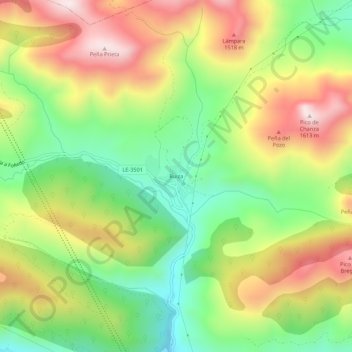
Name: Buiza topographic map, elevation, terrain.
Location: Buiza, La Pola de Gordón, León, Castilla y León, 24608, España (42.87472 -5.70674 42.91472 -5.66674)
Average elevation: 4,268 ft
Minimum elevation: 3,428 ft
Maximum elevation: 5,276 ft
Thank you for supporting this site ❤️
Make a donation
Make a donation
Gear up for your next adventure:
As an Amazon Associate, this site earns from qualifying purchases at no extra cost to you.