Geolocate

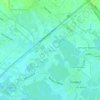
Maquiapo topographic map

Click on the map to display elevation.

About this map

Name: Maquiapo topographic map, elevation, terrain.

Location: Maquiapo, Pangulo District, Guagua, Pampanga, Central Luzon, 2003, Philippines (14.98319 120.54871 14.99961 120.57204)

Average elevation: 62 ft

Minimum elevation: 43 ft

Maximum elevation: 92 ft

Other topographic maps

Click on a map to view its topography, its elevation and its terrain.
San Juan

Philippines > Pampanga > Guagua

Average elevation: 10 ft

Lambac

Philippines > Pampanga > Guagua

Average elevation: 56 ft

Natividad

Philippines > Pampanga > Guagua

Average elevation: 39 ft

Jose Abad Santos

Philippines > Pampanga > Guagua

Average elevation: 20 ft

San Pablo

Philippines > Pampanga > Guagua

Average elevation: 10 ft

Purok Dayat

Philippines > Pampanga > Guagua > San Jose

Average elevation: 16 ft

San Isidro

Philippines > Pampanga > Guagua

Average elevation: 10 ft

Purok 2

Philippines > Pampanga > Guagua

Average elevation: 13 ft

San Matias

Philippines > Pampanga > Guagua

Average elevation: 13 ft

San Pablo

Philippines > Pampanga > Guagua

Average elevation: 10 ft

Pulong Masle

Philippines > Pampanga > Guagua

Average elevation: 98 ft

Gear up for your next adventure:

🧭Orienteering Set - Complete compass and map reading kit
🧭GPS Watch Accessories - Bands and chargers for GPS watches
🪓Survival Multi‑Tool - Versatile tool for camp and trail tasks
🗻Climbing Gear Basics - Essential gear for beginner climbers
🌡️Portable Weather Meter - Track weather conditions on the trail

As an Amazon Associate, this site earns from qualifying purchases at no extra cost to you.