
Make a donation
Gear up for your next adventure:
As an Amazon Associate, this site earns from qualifying purchases at no extra cost to you.
Diegem-Lo topographic map
Click on the map to display elevation.
Make a donation
Gear up for your next adventure:
As an Amazon Associate, this site earns from qualifying purchases at no extra cost to you.
Diegem-Lo
In het midden van de negentiende eeuw werd het zuidelijke deel van de Lostraat (ten zuiden van de huidige Filip Kleermaekerstraat) aangelegd. De Lostraat werd de eerste verharde straat van het gehucht en nam de functie van de Kleermaekerstraat over. Tot 1891 was er echter nog geen bebouwing langs de zuidelijke Lostraat en bevond de kern van het gehucht zich nog steeds in het noordoosten, op het huidige luchthaventerrein. Rond de eeuwwisseling begon het gehucht relatief sterk te groeien. In 1900 werd er een gemeenteschool gebouwd, die rond 1911 uitgebreid werd. De topografische kaart van 1924 toont dat het gehucht naar het zuiden is uitgebreid. Er is nog geen kerk, maar ook de Filip Kleermaekerstraat en de Ferdinand Campinestraat werden verhard. Er was voornamelijk langs de Lostraat en de Campinestraat nieuwe bewoning bijgekomen.
Make a donation
Gear up for your next adventure:
As an Amazon Associate, this site earns from qualifying purchases at no extra cost to you.
About this map
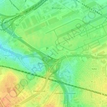
Name: Diegem-Lo topographic map, elevation, terrain.
Average elevation: 118 ft
Minimum elevation: 56 ft
Maximum elevation: 187 ft
Make a donation
Gear up for your next adventure:
As an Amazon Associate, this site earns from qualifying purchases at no extra cost to you.