
Lago Poopó topographic map
Interactive map
Click on the map to display elevation.
About this map
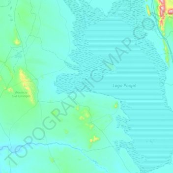
Name: Lago Poopó topographic map, elevation, terrain.
Location: Lago Poopó, Provincia Sur Carangas, ORU, Bolivia (-19.18450 -67.42261 -18.43434 -66.82699)
Average elevation: 12,208 ft
Minimum elevation: 12,057 ft
Maximum elevation: 15,131 ft
Other topographic maps
Click on a map to view its topography, its elevation and its terrain.
Lago Uru Uru
Lago Uru Uru, Oruro, Provincia Cercado, ORU, Bolivia
Average elevation: 12,159 ft