
Coronation topographic map
Interactive map
Click on the map to display elevation.
About this map
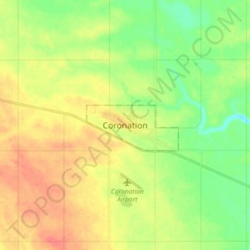
Name: Coronation topographic map, elevation, terrain.
Location: Coronation, Town of Coronation, Alberta, T0C 1C0, Canada (52.05296 -111.48900 52.13296 -111.40900)
Average elevation: 2,585 ft
Minimum elevation: 2,503 ft
Maximum elevation: 2,674 ft