Geolocate

Sprucedale topographic map

Click on the map to display elevation.

About this map
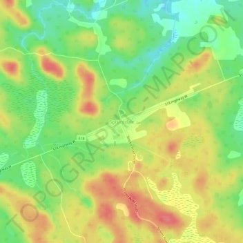
Name: Sprucedale topographic map, elevation, terrain.

Location: Sprucedale, McMurrich/Monteith Township, Parry Sound District, Central Ontario, Ontario, Canada (45.46981 -79.48340 45.50981 -79.44340)

Average elevation: 1,083 ft

Minimum elevation: 971 ft

Maximum elevation: 1,191 ft

Other topographic maps

Click on a map to view its topography, its elevation and its terrain.
Gear up for your next adventure:

👟Men's Trail Runners - Lightweight footwear for fast-paced exploration and light hiking
🧥Men's Rain Shells - Premium waterproof and breathable jackets for mountain weather
🔌Solar Panel Charger - Charge gear sustainably outdoors
🧣Hiking Neck Gaiter - Multi‑use neck protection for outdoor weather
🪶LED Camping Lantern - Bright lantern for camp lighting

As an Amazon Associate, this site earns from qualifying purchases at no extra cost to you.