Geolocate

Trees topographic map

Click on the map to display elevation.

About this map

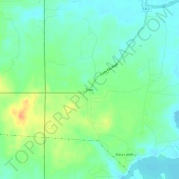
Name: Trees topographic map, elevation, terrain.

Location: Trees, Caddo Parish, Louisiana, United States (32.76764 -94.05102 32.80764 -94.01102)

Average elevation: 213 ft

Minimum elevation: 167 ft

Maximum elevation: 299 ft

Caddo Parish trails, hiking, mountain biking, running and outdoor activities

Other topographic maps

Click on a map to view its topography, its elevation and its terrain.

Blanchard

United States > Louisiana > Caddo Parish

Average elevation: 249 ft

Mooringsport

United States > Louisiana > Caddo Parish

Average elevation: 207 ft

Rodessa

United States > Louisiana > Caddo Parish

Average elevation: 220 ft

Greenwood

United States > Louisiana > Caddo Parish

Average elevation: 266 ft

Belcher

United States > Louisiana > Caddo Parish

Average elevation: 184 ft

Gear up for your next adventure:

🧥Waterproof Jacket for Hiking - Breathable and rugged rain jacket for outdoor excursions
🪶Thermal Camp Blanket - Extra warmth for cold nights
🎒Outdoor Daypacks - Lightweight backpacks designed for carrying maps and essential gear
🌐World Map Poster - Decorative world maps with topographic info
🗺️NatGeo Topo Maps - High-quality waterproof printed topographic maps of US Parks

As an Amazon Associate, this site earns from qualifying purchases at no extra cost to you.